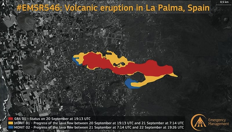
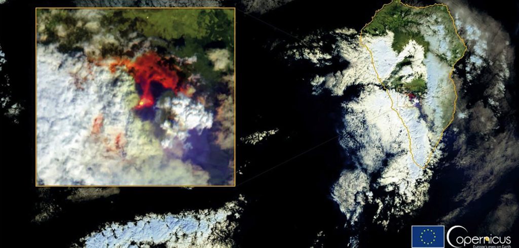
The volcano erupted on September 19 at ‘Cumbre Vieja’ (La Palma) and, since then, satellites Sentinel-2 and Paz have been assisting authorities in examining the damages and forecasting the path of the lava flow.
The European Union has activated the Copernicus service to keep the region where the La Palma volcano eruption took place under control; this enables the visualization of the lava flow, its size and the buildings affected in its path.
The data collected by the Sentinel-2 and Paz satellites offers information on the deformation of the land surface and the state of theroads; and the atmospheric services offer information on the emissions that are taking place as a result of the eruption, such as sulfur dioxide.
The Copernicus satellite based Earth Observation space program started in 2008 and the quality of its data, products and services, as well as the ‘open and free’ policy applied to the data it provides, have turned it into a model of excellence around the world.
It is comprised of a satellite component, with satellites called ‘Sentinels’, and national and private missions providing additional support.
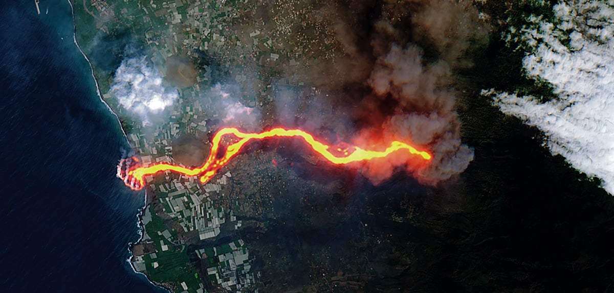
La Palma’s lava flows toward the sea

This image, captured by the Copernicus Sentinel-2 mission on September 30 shows the flow of lava from the erupting volcano in the Spanish island of La Palma. The lava flow can be seen pouring into the Atlantic Ocean, extending the size of the coastline. This “lava delta” covered 20 hectares when the image was taken.
A crack opened up in the Cumbre Vieja volcano on September 19th, spewing columns of ash and lava into the air. The lava flowed past the mountain and through the towns, engulfing everything in its path. By September 28st, the 6 km flow of lava had reached the ocean on the west coast of the island. Clouds of white steam were reported where the red hot lava reached the water in the Playa Nueva area.
This image of Sentinel-2 has been processed in true color, using the short wave infrared channel to highlight the lava flow. The Sentinel-2 mission is based on a constellation of two identical satellites, each with an innovative wide swath high resolution multispectral image generator with 13 spectral bands to monitor changes in the soil and vegetation of the Earth.


