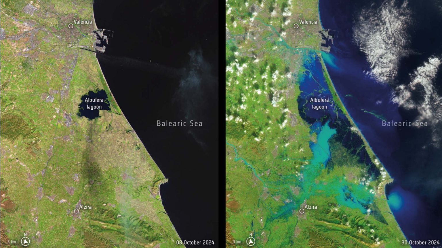
Spain is experiencing its worst floods in decades after torrential rains slammed the eastern province of Valencia. The death toll is on the rise and people are missing.
In response, the Copernicus Rapid Mapping Emergency Service has been activated to provide satellite images in support of rescue and recovery efforts.
According to the Spanish State Meteorological Agency (Agencia Estatal de Meteorología, AEMET), on 29 October, 2024, Valencia was subject to one year’s worth of rain in just eight hours. This downpour caused devastating flash floods, turning streets into rivers, destroying homes and dragging vehicles.
These images by the United States’ Landsat-8 satellite clearly show the magnitude of the disaster, with images from 8 and 30 October revealing the dramatic transformation of the landscape.


