Polar Regions are of paramount importance in the balance of global climate. Due to its geographic isolation, difficult access and large surface, Earth Observation satellites are particularly well-suited to study and monitor its environmental parameters. Among these parameters, the changes in the depth and area of polar ice are crucial to understand the phenomena associated with climate change, given its influence in Earth’s temperature regulation, ocean currents and sea level fluctuations.
The efforts to comply with international agreements to limit the rise of global temperature are essential in maintaining the conditions in the Poles, and therefore, to control the effects of climate change.
In line with this, the progressive restoration of the ozone layer shows what agreements like these can accomplish when implemented at a global scale. ESA has been monitoring the ozone layer for over twenty years, and current forecasts point to its complete recovery in the next few decades, ending in the recovery of the Polar Regions by 2060.
About the image
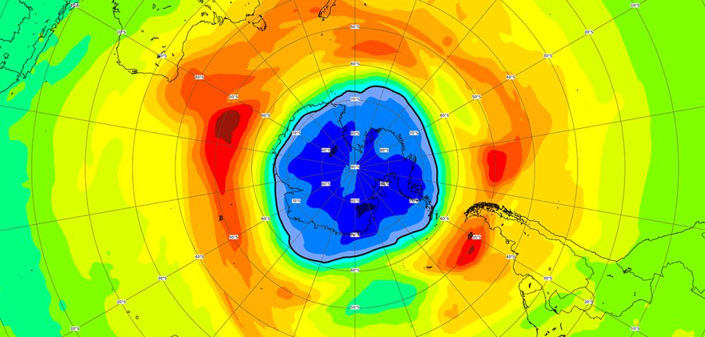
Ozone Hole over the Southern Pole (2021)
The map is centered on the Antarctic region. Areas in yellow, orange and red
represent high ozone values, while areas in green and blue show low values
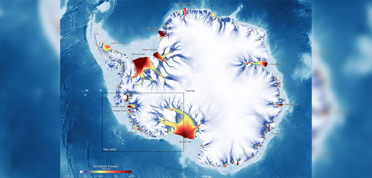
Antarctic ice speed

About the image
The image shows the different glacier flow speeds toward the ocean between 1996 and 2016. Recent research shows that glaciers in the Getz region (inside the black rectangle) are accelerating their flow toward the sea.
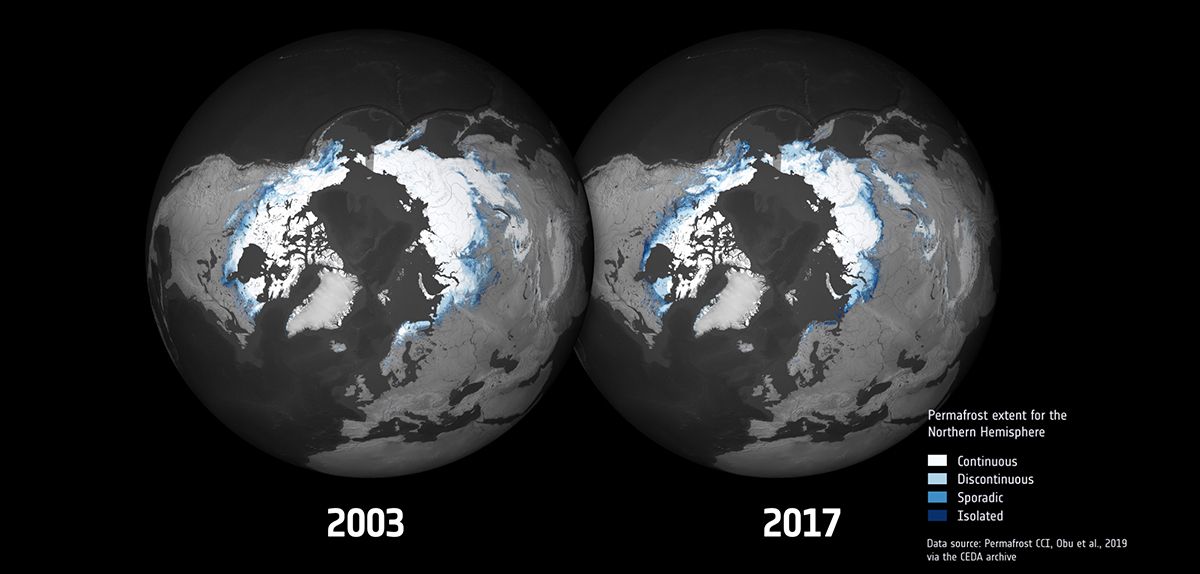
Permafrost cover in the Northern Hemisphere

About the image
The maps generated by the ESA’s Climate Change Initiative offer new information about the melting of permafrost in the northern hemisphere. The image shows the permafrost cover in 2003 compared with 2017.
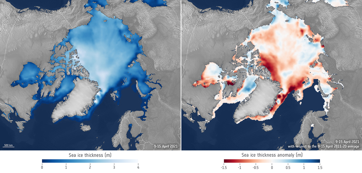
Ice in the Arctic Ocean “atlantifies”

About the image
A combined analysis of data from Cryosat and SMOS allows us to compare the width of sea ice in April 2021 with the average for the same month in the years 2011-2020.


